"DDA: Building Dreams, Shaping Futures"
संकल्पन से सृजन तक

Integrated areas around Tughlaqabad Fort
Integrated areas around Tughlaqabad Fort
Integrated areas around Tughlaqabad Fort
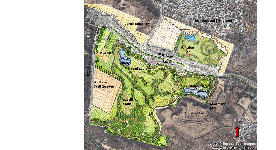
SITE AREA − 149 Acre
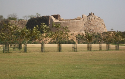
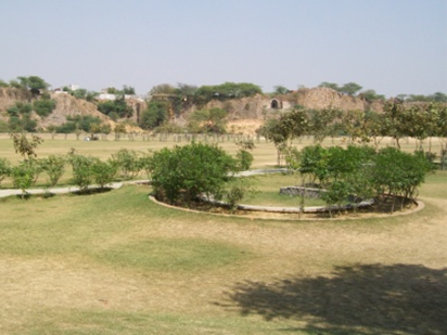
The 271 acres of site is addressed on a holistic level with the rest of the greens around scattered historical built ups. The primary concern in development of the site is to generate one large vocabulary for the cultural, historical, and natural context of the area while fully conserving and enhancing the historical buildings and the inherent distinct character and also to activate the site in public domain and to trace efficient, shortest, and experiential pedestrian routes through the site to orient the visitors towards the monuments located across the corners of the site while conserving the rustic or xeric character, all with minimum possible disturbance. The proposed activities are:
Historic themed Avenues and Courtyards ,Cultural Haat Space ,Amphitheatre ,Playing Maidans ,Elevated Restaurant ,Orchard ,Rustic character seating ,Mounds ,Performance area ,Water bodies with stepped edges
Addressing the dynamics of the cultural and historical aspects, a balanced approach is adopted to integrate the existing historic fabric with larger natural and built environment where the carefully intervened and designed green space acts at one layer as a vast canvas to resonate the components from the local communities and living traditions from the surroundings and sets a model for cultural landscapes in urban surroundings providing a ground for local tourism and neighborhood interactions. Providing strategic ingression points and shortest routes crossing through the park binds it with the warps and wafts of the urban landscape fabric. Resource conservation is a key concern while resurrecting and conceptualizing a landscape character for the site. Water still remains a scarcity and most of the plant selection have been strictly kept to xeric. Planting character majorly constitutes of grasses and trees planned to give a rustic character to the site.